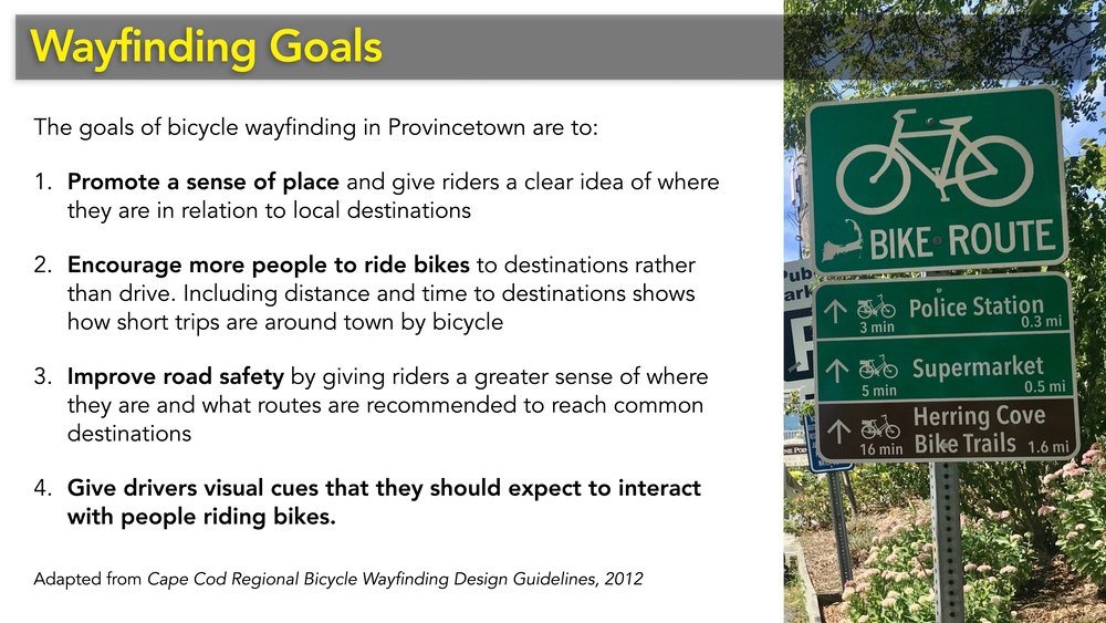
Wayfinding
Bicycle Wayfinding
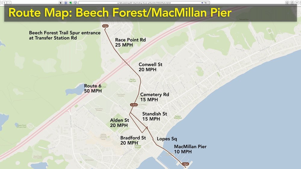
MacMillan Pier/Beech Forest 2023
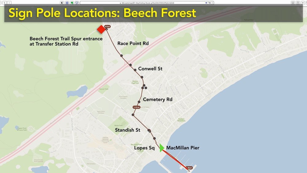
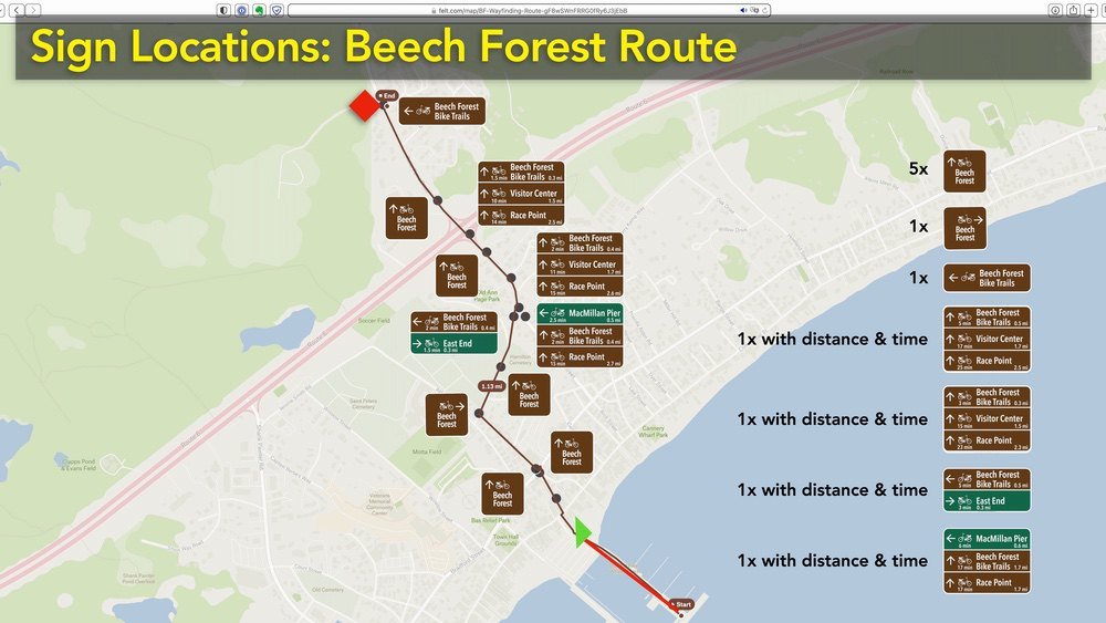
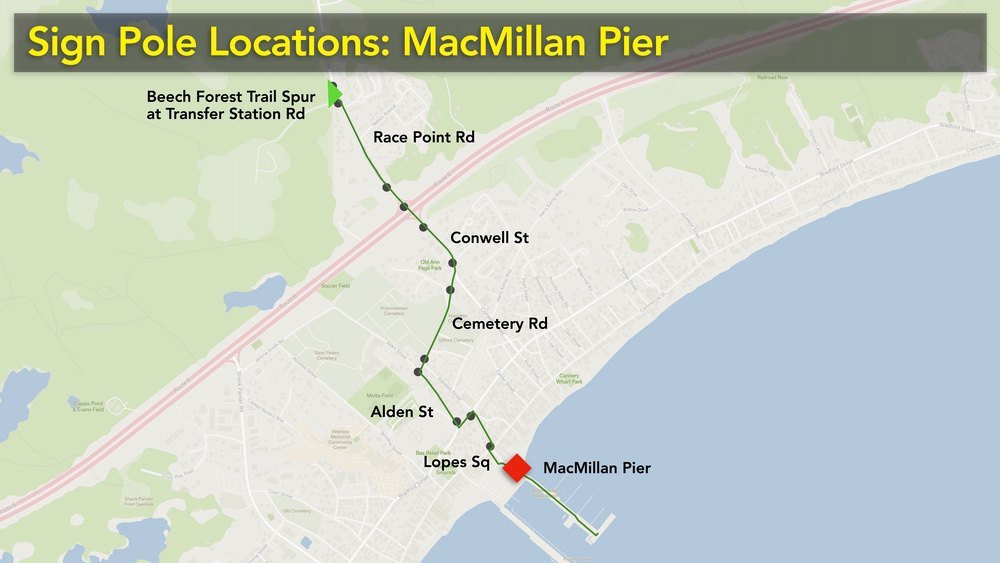
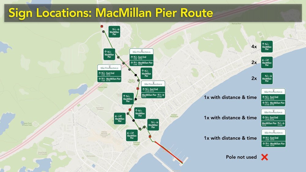
A wayfinding program for the route between MacMillan Pier and Beech Forest was completed in 2023.
This route was identified by the town and Cape Cod National Seashore as an important component of the town’s bike network back in 2011 and was included as a priority in the 2016 master plan.
It encourages riders to use quieter, lower-traffic streets through town and connects with the recently installed bike lanes along Conwell Street. The route is not obvious, so a simple set of signage was developed to provide guidance.
The signs build on the Bradford Street wayfinding program from 2018 and follow the same design standards developed for that project.
2023 Wayfinding Presentation


Bradford Street 2018
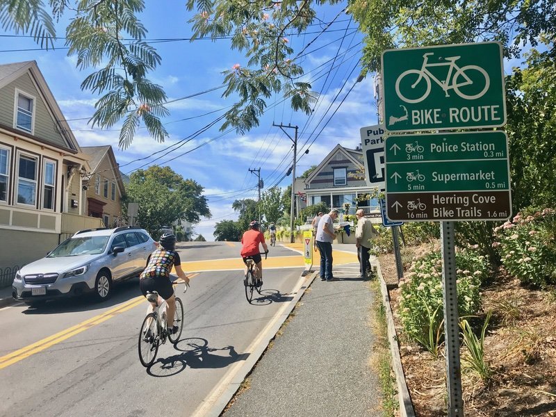
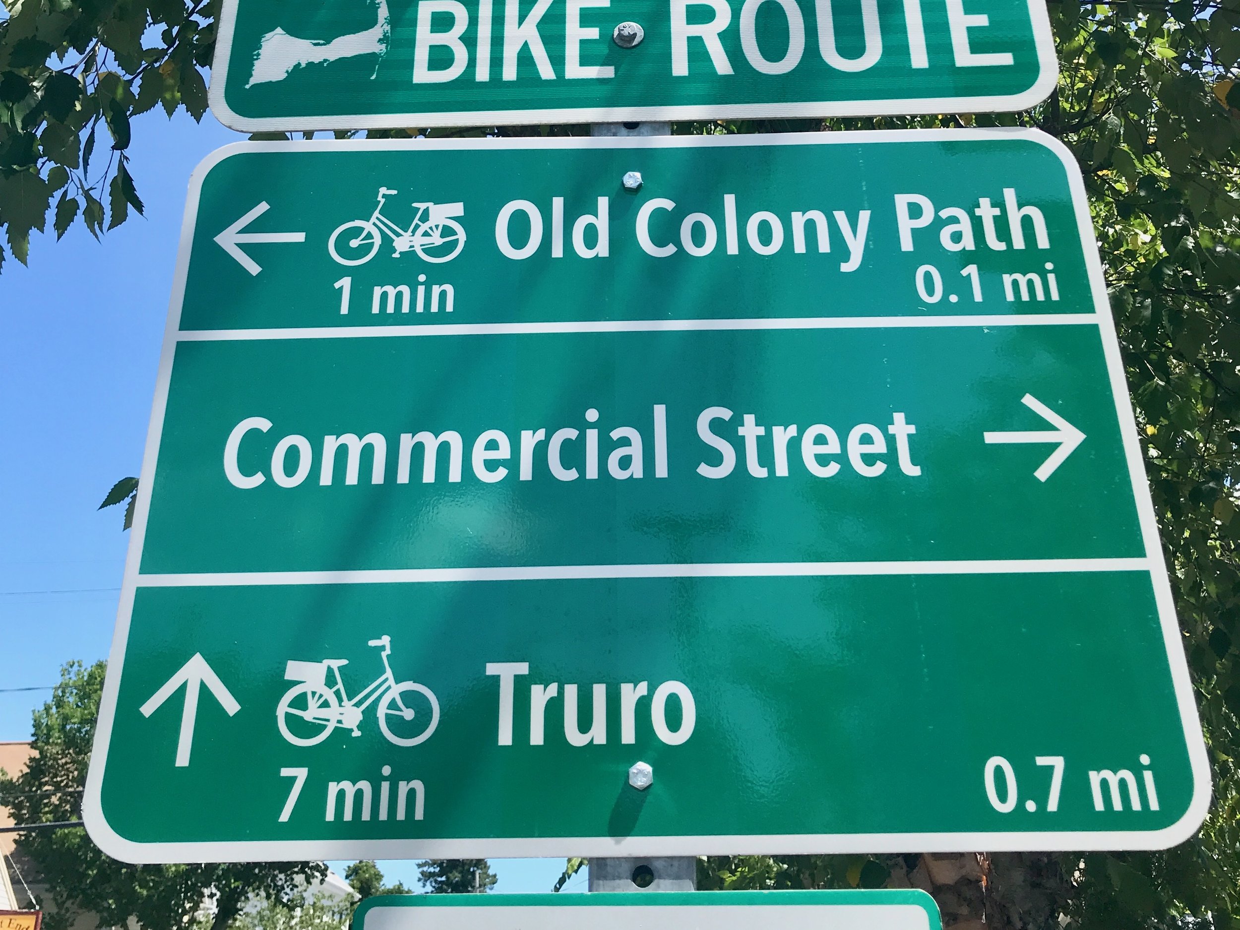
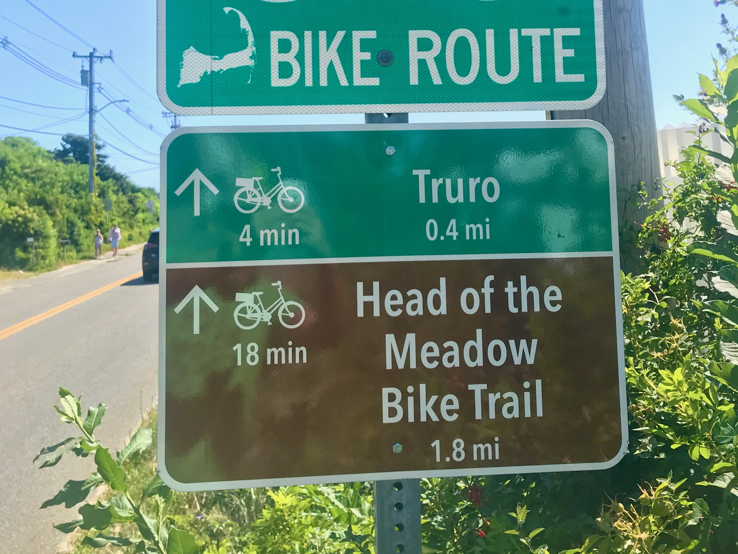
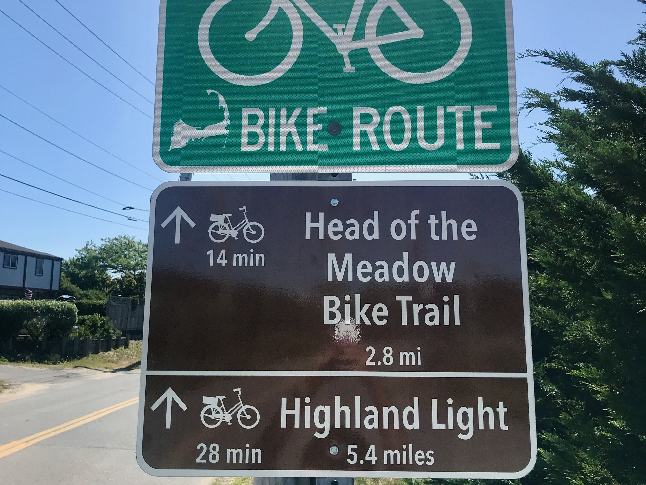
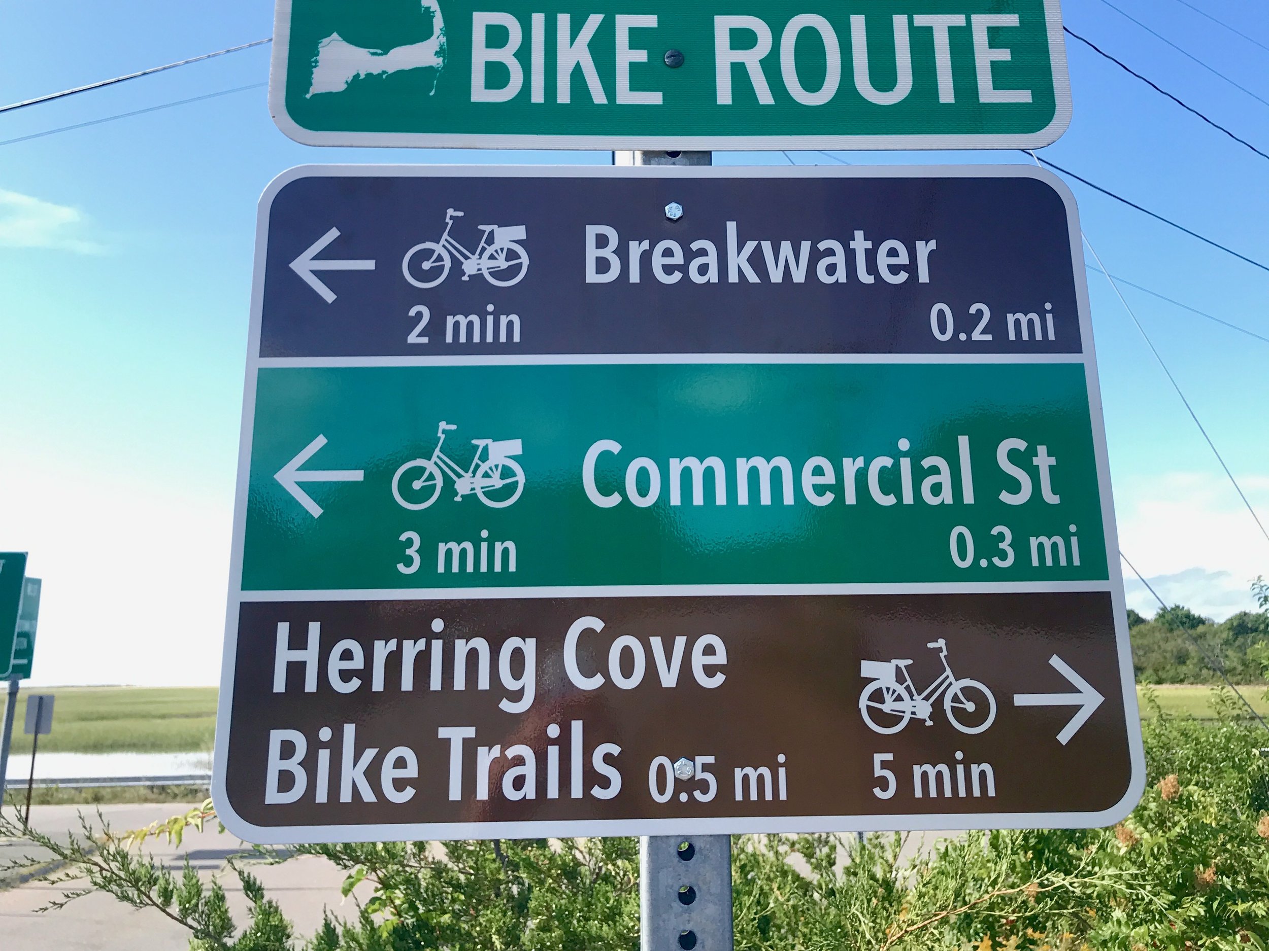
The Bradford Street wayfinding program was completed in 2019. It uses 13 existing poles along Bradford Street, Bradford St. Extension in the West End, and Commercial St. in the far East End. The Bike Route signs were installed by the Cape Cod Regional Transit Authority in 2012. These were intended to have additional wayfinding, but the CCRTA project was never completed. The Bike Route sign with the Cape Cod map was custom printed for the CCRTA by Liddell Brothers.
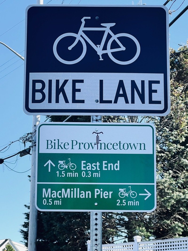
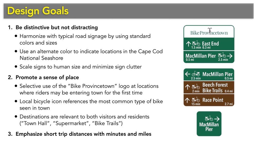
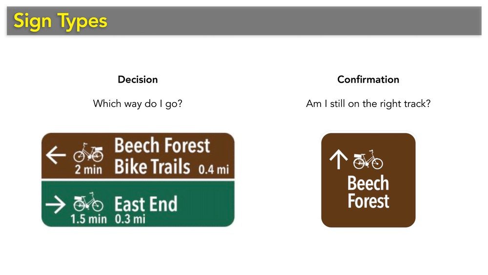
Bike icons reinforce that the directions are for bicycling and used an icon that is more representative of a typical Provincetown bicycle than the standard one on the route sign. The bike icon also changes direction to follow along with the arrows (left facing bike for left arrows, right facing bike for forward and right arrows).
Destinations are also color-coded, with in-town locations in green and places in the Cape Cod National Seashore colored brown.
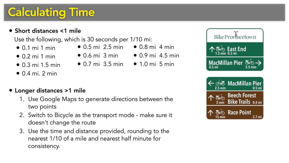
Each of the wayfinding signs shows the time it takes to get to a destination by bike and the distance in miles. Estimates are derived from Google Maps.
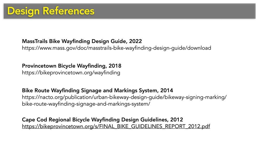
Design resources
The Cape Cod Commission published a guidebook in 2012 that goes into detail on how to develop local destination signage to go along with the Bike Route signs on these poles:
Cape Cod Regional Bicycle Wayfinding Design Guidelines (PDF) »
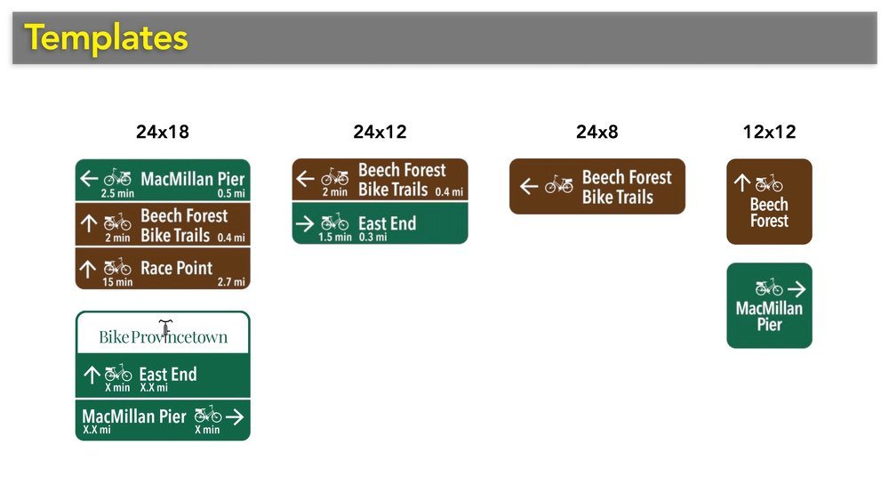
You can do this yourself
You can download this ZIP file that contains templates, design tips, and printing instructions for making your own 24”x18” signs:Adobe Illustrator template files (4 MB ZIP) »
Yard sign printing
The pilot implementation in 2018 was done with simple printed yard signs made from corrugated plastic (coroplast) attached to the poles with zip ties and double-stick tape. Most didn’t last very long, since the windy conditions in town caused the signs to fold around the poles along the corrugation lines and eventually fall apart.
The pilot install was helpful to get feedback, and we made a number of improvements to the arrows and text to improve clarity for the final run of metal signs.
Metal sign printing
We used SmartSign.com to print the final metal versions on standard aluminum, engineer-grade sign stock with a reflective coating.
They converted our PDF files and color corrected to match the federal Manual of Uniform Traffic Control Devices standards colors for road signs.
SmartSign.com »
Eastbound
The first pole heading east along Bradford Street is at Atlantic Ave. just before Shank Painter Rd., and the final one is at the town line with Truro (see the map below for all pole locations).


Westbound
The first pole heading west into town is at Howland Street just before the East End Market, and the final one is at Province Lands Road.


Destinations Included
Town destinations (green):
- Town Hall (5)
- Police Station (4)
- Supermarket (3)
- Dog Park (1)
- MacMillan Pier (3)
- Old Colony Path (2)
- Commercial St. (3)
- Truro (3)
Seashore destinations (brown)
- Breakwater (2)
- Race Point (2)
- Herring Cove Bike Trails (4)
- Beech Forest Bike Trails (4)
- Head of the Meadow Bike Trail (2)
- Highland Light (1)
Map of Bike Route Pole Locations
Pole locations are in blue (eastbound) and green (westbound); destinations are marked as red diamonds.
Others destinations to consider for a more comprehensive wayfinding scheme...
With East Coast Greenway & the Cape Cod Commission:
- Claire Saltonstall Bikeway/ East Coast Greenway route signs. This sign that indicates you’re traveling along both of these routes.

With the Visitor Services Board, Chamber of Commerce, and Provincetown 400:
- East End/West End/Town Center (some existing signs)
- 1620 locations: Pilgrim Monument & Museum, Pilgrim’s First Landing Park, Mayflower Compact Bas Relief (Monument has its own signs)
- Restroooms (some existing signs)
- Public Parking, Route 6 (lots of existing signs).
With the Cultural Council:
- Specific cultural institutions such as the Library, Waters Edge Cinema, Art House, PAAM, Provincetown Theater, Fine Arts Work Center, LBGT Welcome Center, The Commons, West End Childrens Sailing Club, etc.
- Town facilities such as the School, Fishermen Hall, Veterans Memorial Community Center, Skate Park, Motta Field (no signs for any of these currently)
- Churches (some already have signs).
With the Open Space Committee:
- Conservation areas such as Clapps Pond, Shank Painter Pond, Nicky’s Park, etc. (existing signs at the destinations)
With the Airport & Outer Cape Health:
- Airport (numerous signs already)
- Health Clinic (some existing signs).