Reimagining Route 6
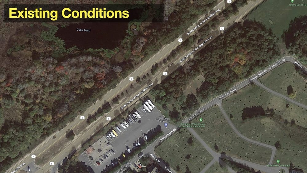
Route 6 as it is today. Shank Painter Road intersects at the lower left, and the signalized intersection with Conwell St is about 2000 ft to the upper right. (Google map)
Request for Proposals
The town issued a request for proposals last week for a consultant to come up with concepts for adding 60 parking spaces along part of Route 6 and a bike trail along the entire length to the town line at Truro.
There were two responses, one by Environmental Partners (who already do a lot of civil engineering work for the town and did the engineering for the Conwell St bike lanes and sidewalk project) and the second by SLR, who gave lots of examples of previous work in designing parking lots and multi-use paths and included a landscape architect on their project team. It remains to be seen which contractor the town will select.
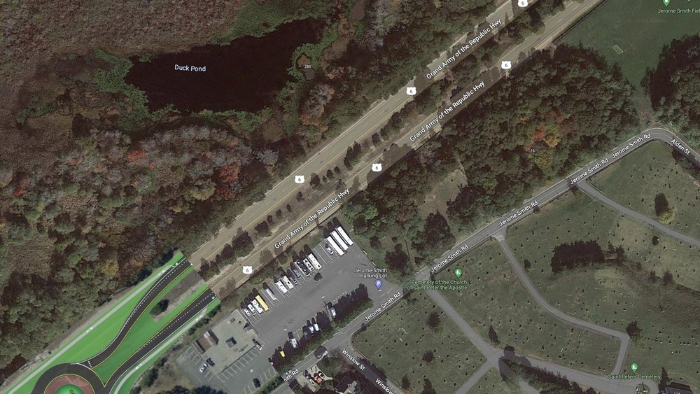
Existing Conditions
Route 6 is a four lane, 50 MPH highway that is way overbuilt for the amount of traffic that uses it (fewer than 9,000 vehicles per day at the peak of the summer season, and only a few thousand beyond Shank Painter Rd).
The town is already planning a redesign for the section from Shank Painter Rd to Herring Cove Beach in the Cape Cod National Seashore, where one side will become two-way traffic and the other will be a wide bike and walking path. The total width of the right of way varies throughout, and the current layout is about 100 feet edge to edge. There's a huge median (about 50 feet wide) between the existing two-lane roadways. There are also some adjacent sewer effluent beds and some sewer lines through the median (the town’s sewer treatment plant is on the north side of Route 6 just past Shank Painter Rd).
To put parking along Route 6, you need to provide some way for people to walk, bike, or bus into town. It's currently a long, unpleasant walk along sand shoulders next to high-speed traffic.
The segment for parking between Shank Painter are and Conwell St intersections is about 2000 feet. There’s a roundabout planned for Shank Painter but no current plan to rebuild the Conwell intersection.
Getting Started
I downloaded maps from the RFP, the town’s Mapsonline tool, and Google satellite images. I pulled them into Apple Keynote, established a rough scale, and started sketching. I also fired up Streetmix in my web browser to do section mock-ups.
I did some simple math and came to the conclusion that angle parking is the most efficient use of space, both in terms of overall space and in parking density to reduce the distance for people to get into town. (Parallel parking would require longer spaces.) I assumed that road lanes are 11 feet, the bike trail is 12 feet, and an angle parking space is 9x18 feet.
I overlayed the planned Shank Painter Road roundabout on the latest Google satellite image and used this for the base map for my visualizations.
Where to Put the Bike Trail
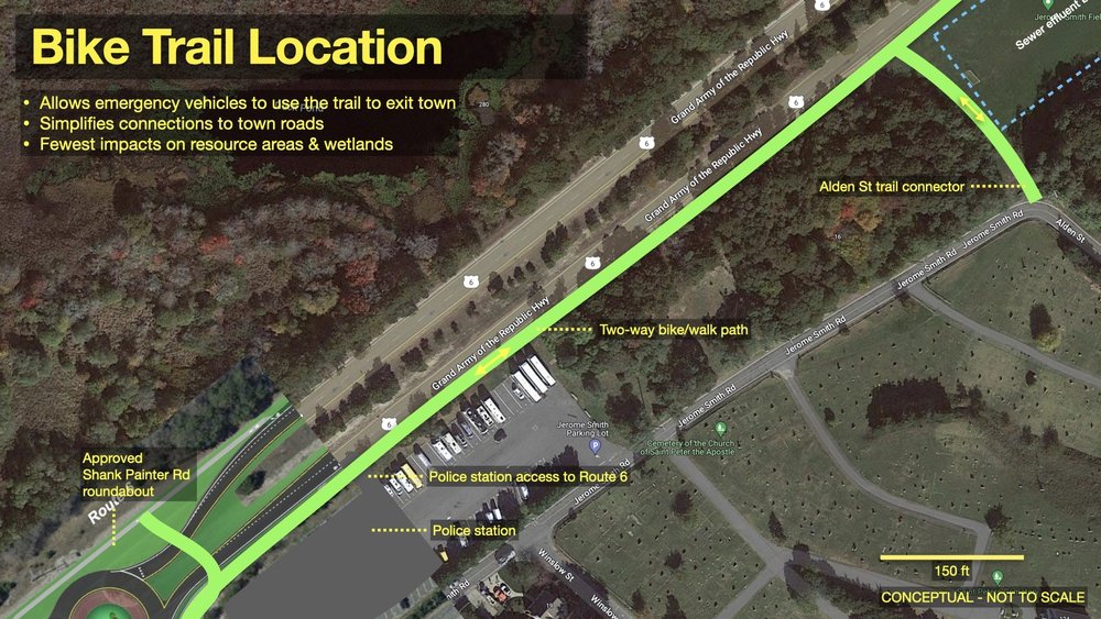
Then I looked at where to put the bike trail. I tried the north side of the roadway, a center median trail, and a south (town) side trail.
The south side trail seems the best option since it’s closer to town, allows for easier access to local streets, and isn’t immediately adjacent to wetlands. It also allows the trail to be used by emergency vehicles and as an evacuation route during a disaster.
There’s a relatively wide sand shoulder already existing on the south side. There are a number of conservation areas along the south side further past Conwell St with walking trails that could easily be connected to a south side trail. Alden St used to connect through to Route 6, so it would make sense to reconnect it as a bike trail along the edge of the soccer field. The soccer field has a sewer effluent bed underneath it, so it can’t be used for parking but should be fine with a low-volume walking and biking trail.
Visualizing Alternatives
I put my armchair planner hat on and started sketching out some ideas. After lots and lots of revisions and abandoned concepts, I came up with three scenarios:
- Median parking lot
- New service street
- Boulevard and linear park
1 - Median Parking Lot
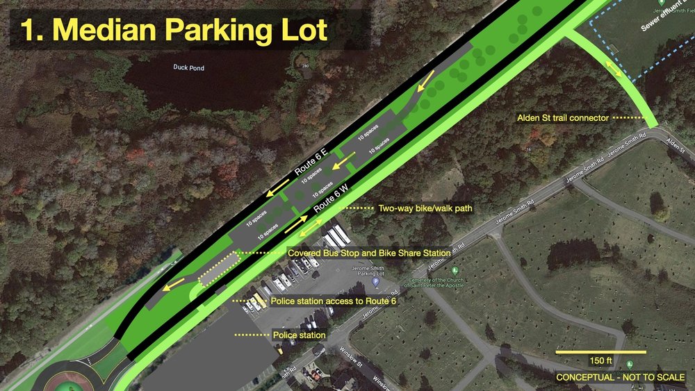
Initially it seemed that just building a parking lot would be simple. So I bulldozed a chunk of the median, put in an access road, and lined it with parking on both sides. I broke up the parking into 10-space bays with a little patch in between each bay for a tree and shrubs.
It ends up being a rather vast swath of asphalt. It kills lots of existing trees (the little green dots indicate approximate existing tree locations). It would probably require a bit of fill to level the median. The parking lot also needs to be very wide since you need an access aisle, so there’s no space for a walkway.
To meet the multimodal needs, I put in a bike share station and bus stop and a little connection across Route 6 W for folks to walk or bike into town. I also sketched in the currently-under-construction new police station on Jerome Smith Road and an access road for them to get to Route 6.
This option would be functional, but it feels like it would be an unpleasant place to be. You’d be parking in the middle of two 40 mph lanes of traffic.
I also reviewed the town's zoning code, and it appears that this section of Route 6 is in the Res 3 zone, where parking lots are allowed only by appeal to the Zoning Board.
2 - New Service Street
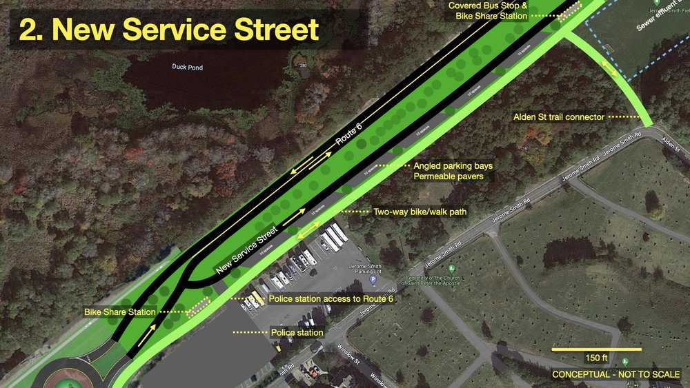
The service street idea is mentioned in the RFP, so I thought I’d give it a go. I put this new street on the south side adjacent to the bike trail. People parking would have easy bike or walking access to the trail to get to town. The driving approach is a little out of the way, since you have to loop through the roundabout at Shank Painter to reach it. But that’s fine for commuter parking (which leads me to wonder: Who is this parking lot for? Visitors? Commuters? Residents?).
This scenario makes the north trunk of Route 6 two-way, which is how it’s configured after the Shank Painter roundabout. It would give the folks who live on Sandy Hill Rd direct access to both directions for the first time.
Again I separate the parking bays with a little planted area to create some shade. Who doesn’t love a tree lined street? The median is kept intact as a median with no changes.
The nice thing about the service street is that it unravels the roads by use, so there is one road for through traffic, another for parking and shuttle bus, and the bike trail for folks who are walking or riding. Everyone gets their own space. But it doesn’t provide any traffic calming on Route 6 to slow drivers down as they approach the roundabout.
3 - Boulevard & Linear Park
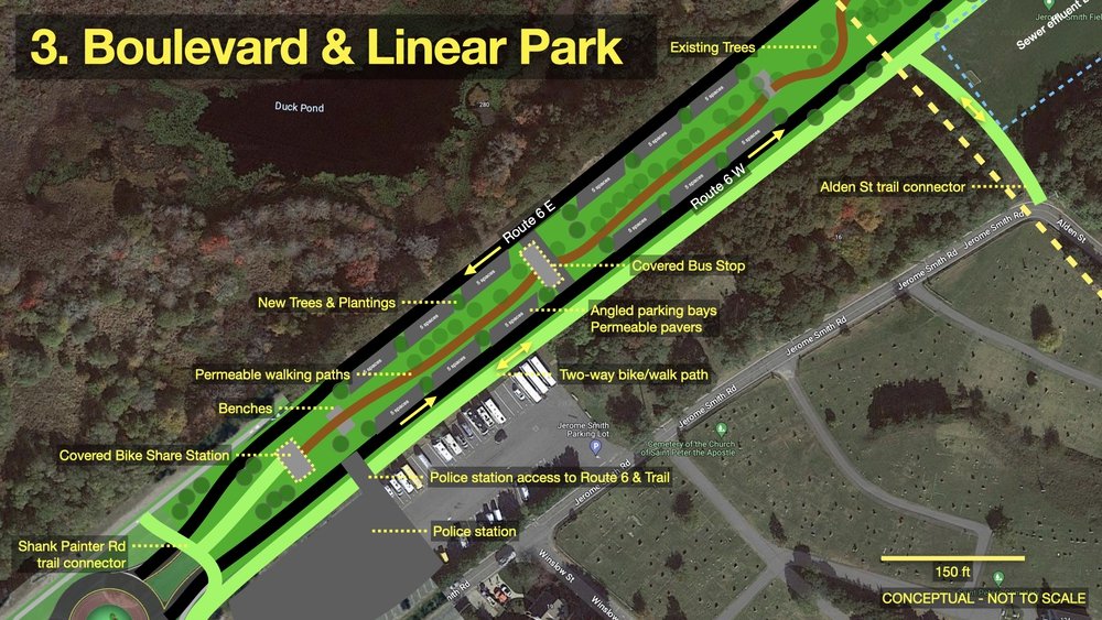
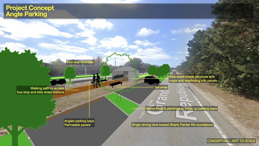
This scenario turns the median into a linear park. This is my favorite, since it turns the median into an actual place. With the walking path, there’s opportunity for public art installations, interpretive panels, and benches.
The parking is angled on both sides, so it can be accessed from either direction in or out of town. Angled parking in this scenario provides a traffic calming effect, since drivers will need to slow down to occasionally allow others to back out of parking spaces.
I located the bus stop in the center so buses can access it from either direction. And it’s a shorter walk from the parking spaces.
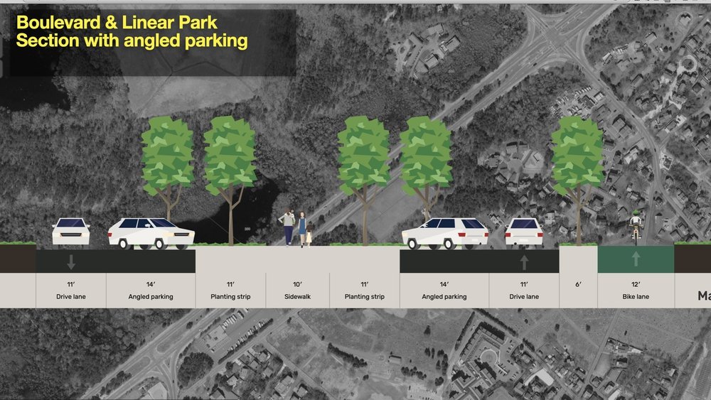
I fired up Streetmix to create a section diagram of the boulevard. Turns out Streetmix is very limited in landscape elements, but this layout gives you an idea of what the boulevard might look like from the groud.
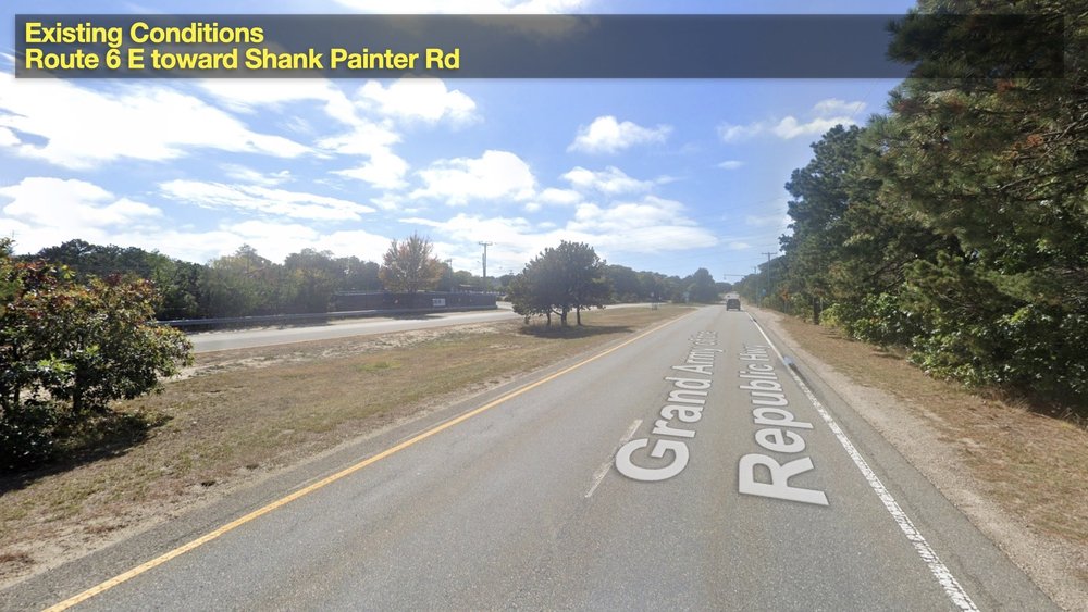
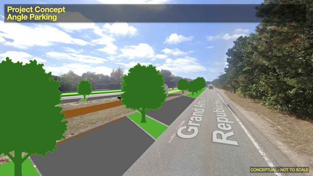
That section was rather lacking in details, so I also mocked up the Boulevard on a Google Streetview image to put it all in some context.
But Wait, There’s More!
The RFP identified a total “parking planning area” of about 2000 linear feet between Shank Painter Rd and Conwell St. Thats’ enough space to repeat any of these concepts two more times - resulting in up to 180 parking spaces in the Boulevard configuration. The dashed yellow lines in these sketches are approximate match lines for the three segments.

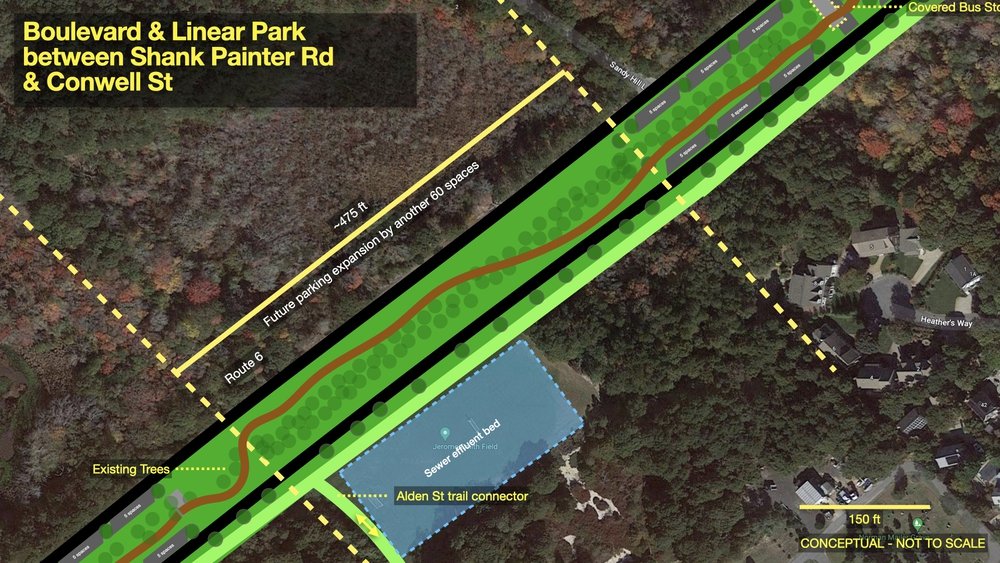
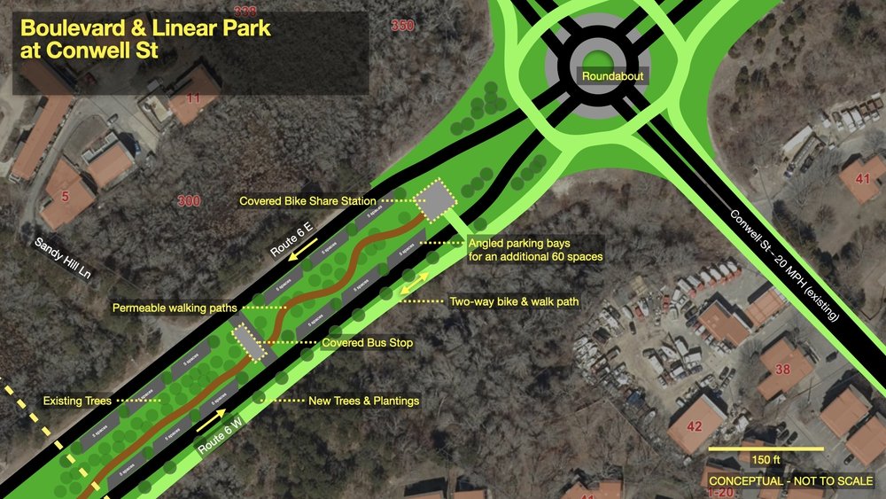
I left the middle section without any additional parking, since it’s a densely forested section that should remain undisturbed if possible.
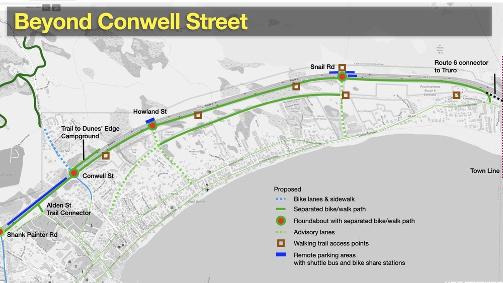
At Conwell Street I added a new roundabout, since the signalized intersection there is outdated, confusing, and crash-prone (most of the injury-causing motor vehicle crashes in town take place there today). A roundabout also provides for separated bike and walking path and easy, short crossings of one-way travel lanes. We’d also need a short, 900 foot long spur trail heading along the north side of Route 6 to the entrance of Dunes’ Edge Campground. Right now folks just wander along the sandy shoulder (I show that in the “Beyond Conwell Street” image below).
Beyond Conwell Street
The rest of Route 6 from Conwell Street to the town line with Truro is roughly 2 miles (over 10,500 feet).
There are additional opportunities for intersection improvements to accommodate the trail, a number of potential connections to walking paths, and the possibility of remote parking lots at Howland Street on the north side of Route 6 and at Snail Road where folks already park along the shoulder at the entrance to the dune hiking trail.
This graphic shows where the town is planning to add bike lanes and a sidewalk along Race Point Rd., a trail to Dunes’ Edge Campground, a few roads where advisory lanes would be a good short-term improvement to slow down drivers and make some space for people on bikes and on foot, and a possible hardened path along the Old Colony Nature Trail between Snail Rd and Howland St. That trail is almost bikeable, but has a few deep sandy spots that make it a rather challenging ride.
Where The Trail Ends
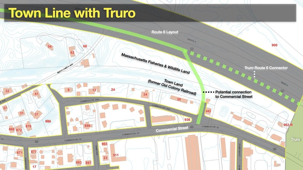
Where to reconnect the trail with Commercial St near the town line is a good topic for further investigation during the feasibility study. The town appears to own a slice of land in the Commercial St layout between 50 Commodore Ave and the house at 942 Commercial St. It shows up on Openstreetmap labeled as ““Howland Street,” and it looks like the homeowner currently uses it as a second driveway. It’s fenced off (apparently by the homeowner) where it abuts the town’s Old Colony parcel, so I haven’t been able to do much more sleuthing on my own.
Truro is in the process of working with MassDOT and its engineering consultant on its own feasibility study for a separated path along Route 6 within their town, but there’s no budget or timeline attached to that project. It makes sense to connect our trail to Commercial St near the town line so that it’s not a dead end. This would also make it possible for bike commuters to use the Route 6 trail to bypass the congestion on Commercial St and Bradford Street to get in and out of town.
I’m looking forward to seeing who the town chooses for the feasibility study and attending lots of public meetings and hearings as they dig into the design and engineering challenges that the project will address. Some day we’ll get to the point when a full design can be created and the town can apply for funding to actually build some of this long overdue trail along Route 6.
